
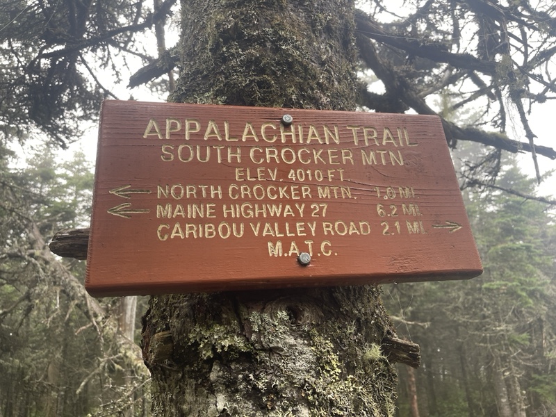
Poplar Ridge Lean-to 1984.6 to South Crocker Mtn 1999.9 (15.3 miles, 974.5 total miles)
This morning was possibly the worst morning I’d had on trail so far. My tent hadn’t fared well in the night, and somehow rain water had gotten all between my ground sheet and tent floor.
There was water seeping through the bottom of my tent, and packing it up in the rain didn’t help, either. Sunshine was gone by the time Catchup and I woke up at 7AM, and we procrastinated in the shelter for a bit after Long Story left, trying to wait out some of the rain.
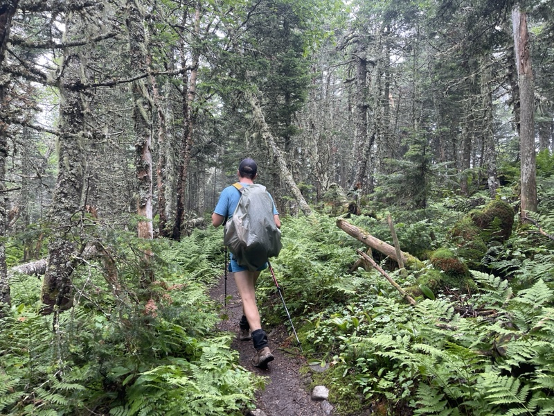
We headed out at 9, to almost 6 miles of easy hiking, down and halfway up Lone Mountain. The rain got better after a few miles, and I used my rain jacket as a pack cover again.
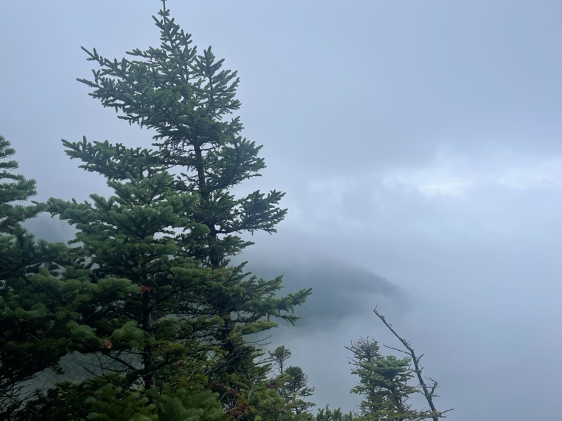
The day was foggy and wet for the remainder, however. The sun didn’t come out for more than a weak moment or two at a time. As a flip flopper, I’d never had to deal with wet and cold March and April down south. I’d been spoiled, but it made the day harder for me.
Catchup had plenty of experience backpacking in the rain, and he found ways to enjoy it. Ever the optimist, he pointed out how vibrant green all the leaves and moss around us were, and how quiet the forest is on a rainy day.
I was definitely grumpier than I wish I had been, but he was nice enough to take it in stride. I grudgingly knew that for every miserable, rainy day I hiked through, I would become a stronger backpacker for it.
The climb up Lone Mountain to a wooded summit wasn’t too bad. We had to navigate carefully, as the trail was full of rocks and roots again, and both were slick from the water.
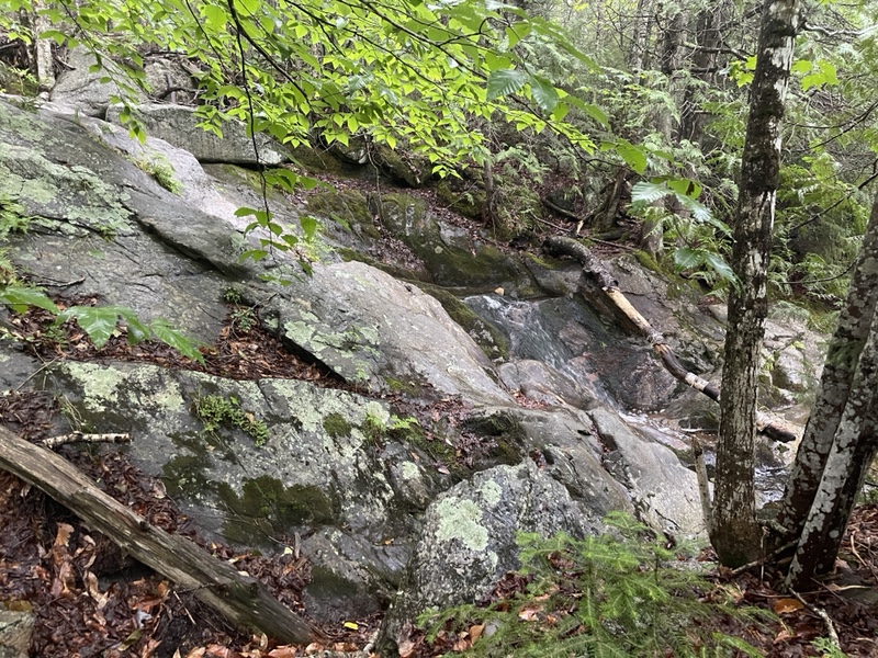
Between the shelter and mountain, we passed several water sources that were flowing much more strongly than anything we’d seen before the rain.
I knew the rain had been necessary, as a lot water sources listed as seasonable and even reliable had been dry or stagnant this year.
It was hard not to ruminate on my wet tent and footprint packed in my bag, and the rain we’d be having for possibly several days further.
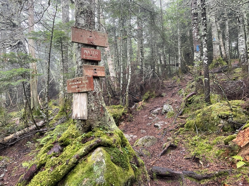
When we reached the Spaulding Mountain Lean-to after 2 flat miles from Lone, we found a few other hikers. Rave was a friendly and forthcoming SOBO that we chatted with for a bit, and there were a couple other flip floppers there as well.
After a half hour we headed back onto the trail. Catchup had told me about how changing his gait had helped keep weight off his calves, which I experimented with as we hiked.
It seemed to help, but my knees were definitely struggling. My feet were also in pain after walking on rocks so much lately.
Comparatively, if I was a NOBO, I’d be in northern Virginia right now based on my mileage, which would put me in prime Virginia Blues territory.
Virginia Blues are when the honeymoon period of a thru hike is typically over, and the trail becomes much more a test of endurance. I joked with Catchup that instead of going through the Virginia Blues, I was dealing with the Maine Blueberries.
An eighth of a mile took us 800 feet up Spaulding Mountain, where there was a .1 side trail to the summit or another trail to a view. We skipped both because everything was socked in with clouds.
We descended less than a mile to the AT Completion Marker that I’d never heard of before today. It was a plaque on a rock commemorating the final link of the entire Appalachian Trail being completed August 14th, 1937 not far from that spot.
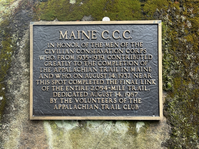
It was a fascinating thing to see, and someone had placed a land stewardship Vermont quarter on top of the plaque, which Catchup and I both thought was a nice touch.
A couple relatively flat miles later, we passed what was supposed to be a spectacular view of Carrabassett Valley. We’d have to take the guide’s word on that once, since we could only see the very edges of the valley around us.
A steep and technical 1.6 took us down to the south branch of the Carrabassett River, and I gathered half a liter of water, enough to get us a little father near Crocker Cirque Campsite.
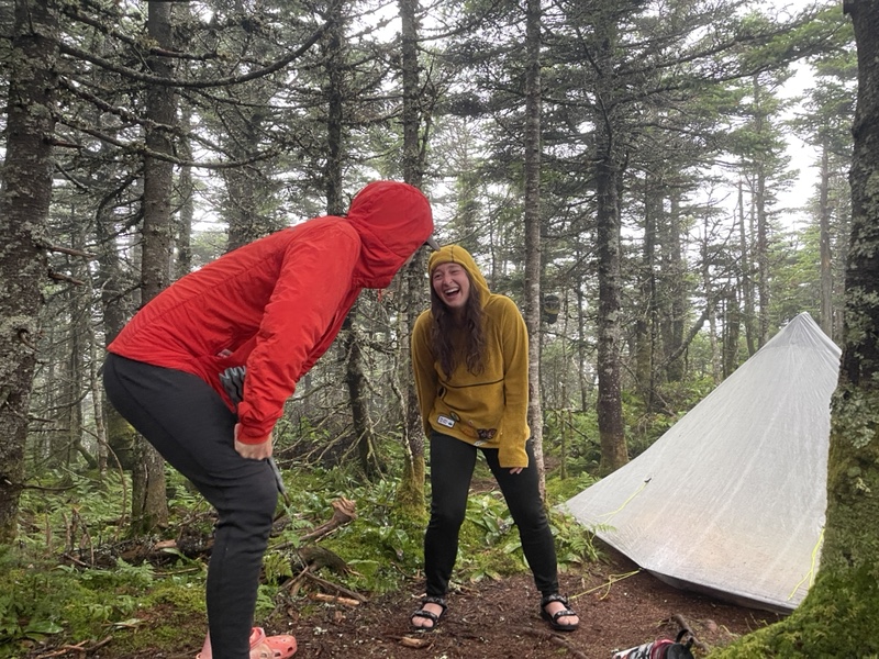
At the campsite, we gathered water for the evening, as we were planning on camping on South Crocker Mountain with Sunshine.
The climb was an extremely steep 1.2 that took us 1,300 feet up in elevation to just before the 2,000 mile marker. We had passed the 200 mile marker for SOBOs a little earlier in the day. In another 25 miles I would hit my 1,000 miles. There were big milestones all around.
Sunshine was set up on the mountain where a few spots were. I did my best to set up my wet tent and rain fly and not be too grumpy about it. Everything being damp was not my ideal way to spend the day.
We had family dinner together before everyone retired for some tent time. Shortly after 8, the rain began coming down again. Water from my rain fly seeped onto my tent’s bug net and dropped onto me and my quilt every once in a while.
It had been one of my most mentally draining days on trail. It was too bad, because the terrain was easier than we’d gotten lately, but maybe it helped the day go better than it could have.
It was nice to be camped on top of a mountain, since we usually started our days with climbs. Tomorrow would start with a descent, and when we stopped to resupply in Stratton, we were going to look for a laundromat to dry our clothes.
The good news was I’d never have to do this day again, and I had some great people around who had my back. Eventually my things would be dry again, one day, but not today.