Fontana Dam 2026.8 to Sassafras Gap Shelter 2049.3 (22.5 miles, 2049.3 total miles)
Happy and I were up early this morning to finish packing and get ready to shuttle back to trail with Nancy at 6:30AM. I was quite tired when I woke up, and alarmed when I saw in the bathroom mirror that half my mouth was swollen from an allergic reaction.
It had started the evening before, and the Benadryl I’d taken hadn’t cleared it up like last time. I’d stopped having hives for the most part, but had no idea what could have caused this. I lay back down for a couple minutes, wishing I could take a zero day, but the Inn was expensive and there were miles to make before the latest hurricane arrived in a couple days.
I remembered I had my buff now, and figured I could hike with it hiding half my face like a bank robber, because I thought I looked ridiculous. My mouth felt like I’d had a Novocain shot on my right side. I took a Dollar General brand antihistamine, resisting the urge to take two, and resumed packing.
After Nancy dropped us off, I hung back at the Visitor’s Center for half an hour finishing my breakfast. The moon was still glowing bright over a pastel sky reflected in Fontana Lake, and as I hiked out at 7:30, I found a spot where I could see the sun rising over another ridge.
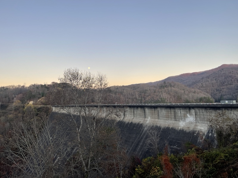
The antihistamine had seemed to work, and my face was returning to normal. I thought back over recent reactions I’d had, and began wondering if I was allergic to a particular food dye. I passed the Fontana Hilton, a very nice shelter, before catching up to Lentil and Looseleaf.
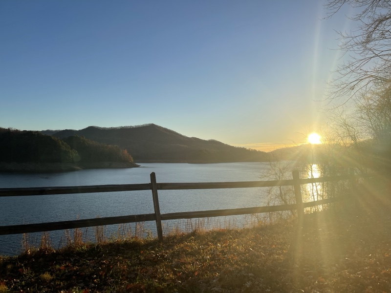
We started hiking together after applying sunscreen, a very good idea of Lentil’s because we were so exposed now without leaves on the trees. We’d all gotten a little too much sun exposure the day before. As we hiked, I told Lentil I was planning on trying to make it to a shelter a few miles further than the group’s planned end point for the day.
We had about 11 miles planned for the day Hurricane Nicole was going to hit us, and I wanted to try to reduce that number as much as I could. I also was interested in seeing the view from Cheoah Bald today, because it was supposed to be cloudy tomorrow. Plus the shelter would have a privy and water, neither of which the planned campsite had.
As I was telling Lentil this, I also mentioned that I’d probably get to see sunset on Cheoah, as I had a feeling I’d be there around 5:30. Once she heard me talk about sunset, she began to reconsider her earlier stance of ruling out going that far, and decided her and Looseleaf would aim for it too.
It would be a challenging day, because it would involve hiking 22.5 miles and an elevation gain of 7,400 feet, but we’d started early and I was feeling much stronger. I noticed my hiking abilities really were enhanced on good weather days, and I wanted to take advantage of that and hike all day as it would be another clear, 70 degree day. The low miles we’d done yesterday had helped rebuild my energy as well.
After our first little hill, we arrived at a set of bathrooms and saw Happy out front. We stopped, and I used the restroom and drank half a liter of water, refilling my bottle. We continued on together, beginning our biggest climb of the day, 2,000 feet up over 3 miles. Happy was on the fence about the new plan, and the three of them ended up passing me and continuing up the incline faster than I was.
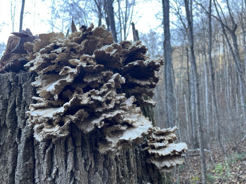
I was fine with that, because hiking alone during the day had become so normal to me now that I really enjoyed it. The incline wasn’t too bad, and had a lot of switchbacks. It also had a plethora of leaves, and I tried to avoid the hidden obstacles under them, but wasn’t always successful.
My right big toe was still hurting, possibly from the stick I’d tripped over the other day. I hiked in silence, clearing out the mental clutter, walking the ridge, then descending to Cable Gap Shelter, where I found the others. It was around 10:30, and we were already 7 miles into the day, and it didn’t even feel like we’d gone that far, a good sign for the longer day.
After a 20 minute break to use the privy, drink a liter of water, and have a snack, I left after the others, though Happy was now on board with the plan. The rest of the group were on trail somewhere behind us, having been dropped off from their hostel a couple hours later than we’d been.
I climbed a little hill to Yellow Creek Gap, where I passed by a group of older women hiking up from the road. They were very encouraging as I answered their questions about my hike as they let me go by. This next climb was a gradual 2 mile ascent, very pleasant with views toward other mountains on both sides when I was running that ridge for a few more miles.
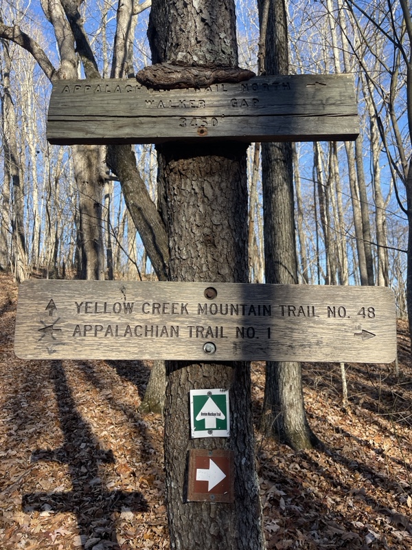
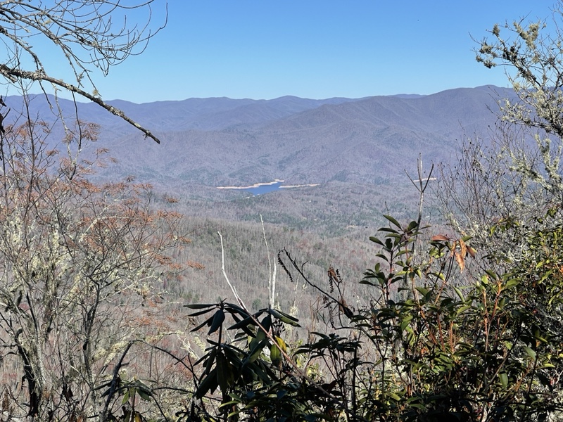
There was one tiny climb that was extremely rocky and steep leading up to a view of the dam, but it was over quickly, and another mile and a half brought me to Brown Fork Gap Shelter, .1 off trail, where we’d all decided to have lunch. The shelter was halfway up a climb that looked harder in the guide than it ended up being.
The others were halfway through lunch when I arrived, and Looseleaf shared some bread he’d packed out with us. I made the mistake of making sandwiches with bacon ranch tuna, and was burping up that taste for the rest of the day. Not only was I absolutely sick of tuna packets, but that flavor in particular was quite unpleasant.
The others left one by one, and Looseleaf was the last to depart, yelling goodbye to me while I was collecting water down a blue blaze. I carried two liters out, which turned out to be both good and bad. Good because I was well hydrated, but bad because I ended up having to stop to pee every half mile, which was rather time consuming.
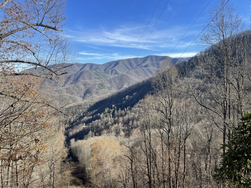
I put on music instead of the audiobook I’d been listening to earlier to liven things up, and it seemed to work very well. I blasted up the rest of the climb, had a few ups and downs on the ridge, then descended to Stecoah Gap, which we’d passed by car with Nancy on the way to and from the hostel.
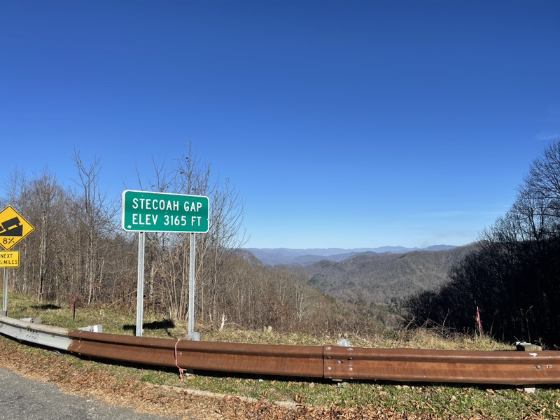
It had a nice view, and I saw the van that was slackpacking Sticky Fingers parked there, who’d I’d seen earlier this morning near the dam. I also spotted a trash can, so I dropped my food wrappers of the day into it before continuing back into the woods.
This mile climb was a little steep, with plenty of log steps to help me up. A couple more ups and downs brought me to Locust Cove Gap, the original destination of the day. The other three had been talking about camping up on the bald 1.1 before the shelter, but I knew I was going to the shelter no matter what. Camping on balds could be windy and cold, plus I still wanted the water/privy combo the shelter offered, and the extra bit of mileage.
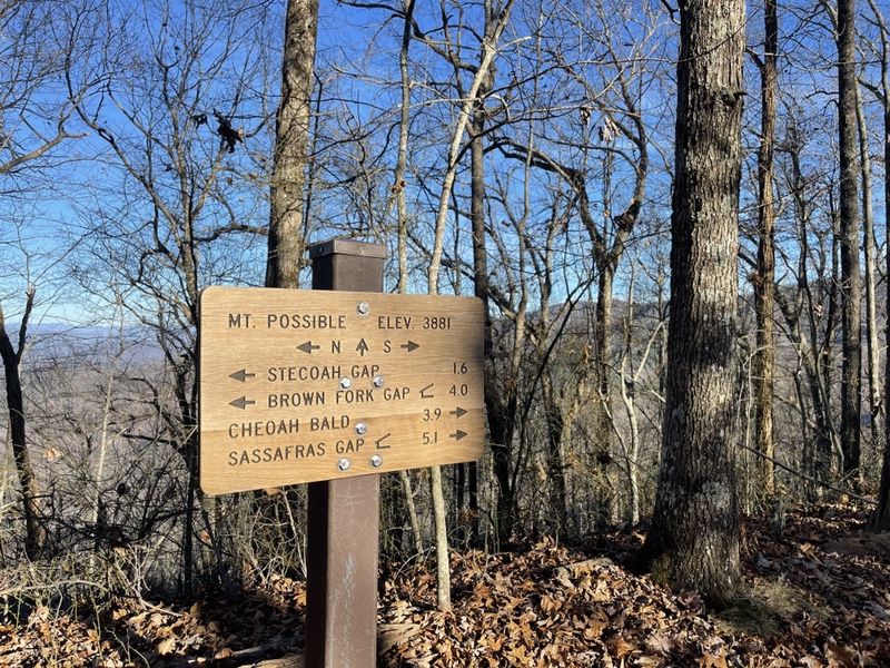
I got to the gap at 4:30, and skipped the side trail to water, deciding to just take up my half liter. I’d eaten a few snacks on my way down the mountain, and was ready to do my best to bang out a 2.5 mile climb of 1,400 feet in an hour so I could catch sunset.
It was hard work. Lentil and Looseleaf had headed up just before me, while Happy was still at the gap when I left. I hiked like my life depended on it, determined that I wouldn’t hike all day to miss sunset by a few minutes.
I played as many upbeat, fast paced songs as I could, watching the sun sink low on the horizon, trying my best not to slip on leaves. That was impossible, and I stumbled and tripped several times, but didn’t fall as I hustled as fast as I could up the climb.
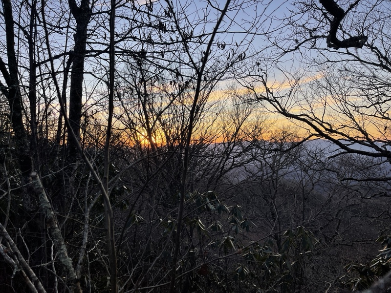
There was a glorious flat spot in the middle for half a mile, and several false summits, which I don’t usually fall for anymore. At times it was all I could do to keep moving forward on the steep sections, feeling sick to my stomach from the exertion. On the switchbacks, I kicked back into high gear and ground out the steps.
I reached the view at 5:30, throwing my trekking poles down and walking to where Looseleaf was. I was disappointed when I saw the view was facing the wrong direction for sunset. Looseleaf said Lentil was ahead, so I picked my poles and pack back up and walked a little more uphill to the top.
A side trail caught my eye, and I followed it until I could see sunset from the other side of the mountain. I called the other two over, and we admired the colors that lingered much longer than the sunset on Max Patch I’d seen. Unfortunately, Happy arrived a bit after the sun went down, and wasn’t in the mood to enjoy it very much, which I understood completely.
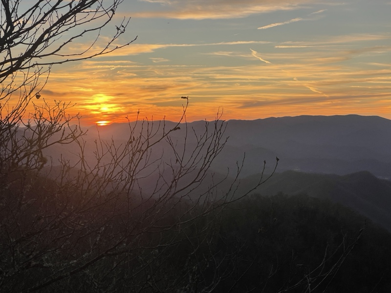
The others abandoned their idea of camping on the bald, and we all headed down the mountain in the light of dusk. The walk down was 1.1 to the shelter, and I listened to Harry Potter again as we went, hiking just behind Lentil and Looseleaf.
The walk went by fast, but I did have to dig out my headlamp from my pack .1 before the shelter when it got so dark I began to feel I was tempting fate hiking through the leaves when they were already so sketchy. The shelter was .1 off trail as well, and we arrived just after 6PM.
There was no else there, fortunately, so we weren’t disturbing anyone by arriving after dark. I took the loft to myself, as Happy wanted to tent tonight, and I knew everyone else preferred the bottom section. This shelter was set up similarly to the ones in the Smokies.
After setting up my things and changing into warm clothes, I made chicken broccoli alfredo from a Knorr side and a chicken packet. I read the logbook while I ate, which was a very unique one that had entries for hikers to answer questions about their day and hike. I enjoyed reading some of my friends’ recent entries, and filling out my own answers as well.
While eating, we realized we’d now reduced our miles on the hurricane day to around 5, because of the extra we’d done today and could do tomorrow. Lentil looked up the weather, and saw we were expecting 1-2 inches of precipitation that day, ranging from rain to sleet.
She speculated that we could take a zero at one of the hostels instead, and still finish the planned day of the 19th. It would be much more pleasant than spending the day in a shelter, and a zero sounded heavenly to me. There weren’t any planned before the end of the hike, and I hadn’t had one in 8 days, which was clearly unlike me, so I was very in for this plan.
Lentil did some calling around and talking to her and Looseleaf’s friend Anna, who could help with shuttling. We’d have to take a far shuttle to Franklin, because the only hostel before that was too close to make the miles we needed to stay on schedule. It would be worth it, we all agreed, to have a day out of the elements.
Only Shady Tree had arrived out of the other group, as Milky Moo, Painkles, and Flamingo had decided to camp on the bald. Happy felt confident they’d be in on the new plan as well, though. We all laid down around 8:00 to rest for the next day, which would be another 20, but would have less elevation gain.
We were all startled around 9PM, when a very large noise rocked out of the forest. Shady Tree thought it was a tree branch falling, and checked on Happy to make sure she was fine in her tent, which she was.
It was fun hiking with the group, and reminded me of being with the Cult. There were eight of us then who were hiking together consistently when I was with them, and the same amount now that I was with the flip floppers. I really hadn’t expected to finish my hike with anyone, so it was a nice surprise that I might finish with them.
Of course I say might, because I’ve learned time and again out here that plans don’t always determine outcomes. I’ve learned to hold plans much more loosely, and to go with the flow more, trying to reign in my expectations. It’s a work in progress, but I’ve made great strides.
I also don’t care so much that I finish with people. If it happens, it’s an unexpected treat. I had the Katahdin experience I wanted with a group, and I could take it or leave it for Springer because this journey is about me, I’ve realized, and I want to stay true to that.
Of course, I really enjoy this group and am happy if I finish with them, but as long as I finish that is what matters now. Achieving the goal for myself, and learning that as long as I have my own back I can withstand anything. The heartache I’ve gone through out here has only made me stronger, and it’s been worth every tear.
