
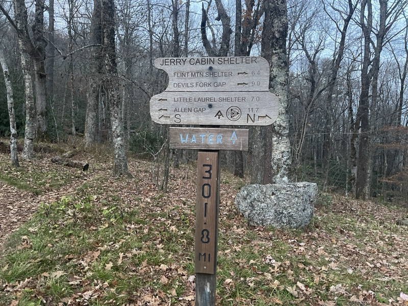
Sam’s Gap 1874.6 to Jerry’s Cabin Shelter 1892.5 (17.9 miles, 1892.5 total miles)
I dozed until 9AM, too comfortable to get up before then. In the middle of the night, I’d awoken with chest tightness and used my inhaler a few times, but when I took my last doxycycline pill in the morning, it was with great relief to be done with medication.
I put on coffee, made Pillsbury cinnamon rolls (a childhood favorite), and got to work repacking and organizing my full pack, my slackpacking adventures of the last few days over with. I also washed the leftover towels and town clothes from our stay, threw in my bedsheets, took out the trash, and did the dishes.
It was a very productive morning, and when Miss Janet called to tell me she was out front and to take my time, I only had a few last minute items to take care of before carrying my pack, trekking poles, and a breakfast bowl out to the van.
We drove once more through the Tennessee countryside, along winding roads and even past Miss Janet’s childhood home. It was shaping up to be another lovely weather day, and I was feeling optimistic that I still had a chance to make an 18 mile day, even with the late start.
Miss Janet hooked me up with a spare sleeping bag liner she had in her van – the one piece of cold weather gear I’d been dragging my feet on buying, and gave me the contact information for another trail angel in the area I’d be going through.
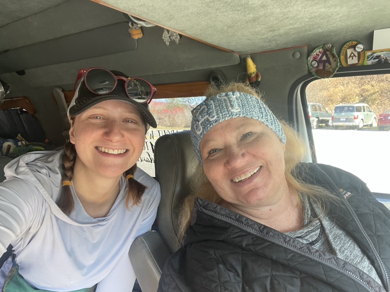
I thanked her for everything, as it had been a truly wonderful time seeing her again and getting to switch up my hike a little bit. I felt so much stronger and well rested than I had when I’d first met with her, and appreciated immensely all she’d done for me.
This time I hiked southbound once more, leaving Sam’s Gap in the opposite direction of my hike the day prior. Under the overpass, across the road and back into the woods, and I was home again. I applied sunblock, then took out my earbuds and queued up the Halloween party playlist.
It was 11:30, and I needed to hike 3mph with an hour grace period for breaks to arrive at camp by sunset, 6:36PM. That meant I didn’t have time to ease into my day, so I put on music to get me going right away.
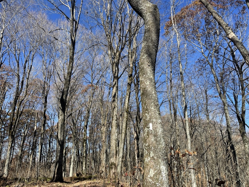
As I began my first couple miles of ascent, I could feel the stark contrast of having my full pack on my back once more. I had a full food bag, plus plenty of town food, and a liter of water, so it was not insignificant and I knew it would feel weird at first, but I’d get used to it again. My feet and knees definitely felt it first, however.
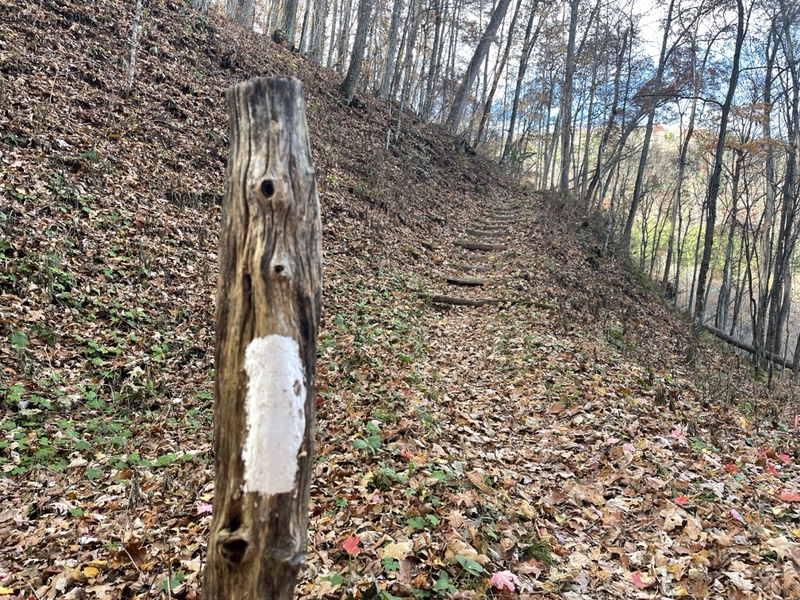
The parking lot at Sam’s Gap had been much more full than the day before, drawing my attention to the fact that it was a Saturday. I passed a couple women on a section of log steps, and answered several questions for them about my hike before I took off again.
Nearly 2 miles in I took a short side trail to High Rock, an almost identical name to a view I’d taken in the day before. I checked out the view for a moment, and a woman up top offered to move out of the way so I could sit and enjoy it better. It was a very kind offer, but I let her know I had many more miles to hike though I appreciated her saying that.
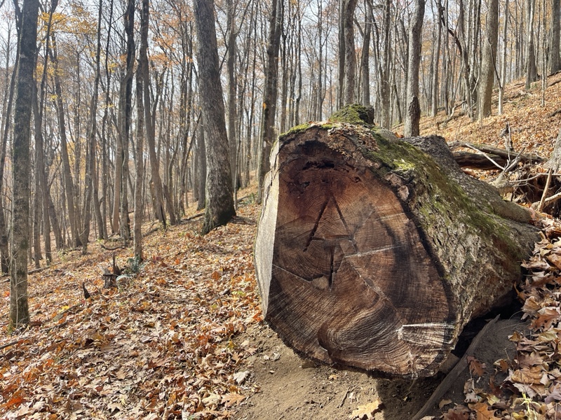
On the downhill, I turned off the music for a bit, and passed by Hogback Ridge Shelter without turning onto the .1 side trail. The leaves were crunching underfoot as much as ever, and I had to take great care where I stepped. I’d been rolling my ankles every once in a while lately, and knew it was imperative I protect my body at all costs. With such a short amount of miles left to hike, I would be devastated if I made a critical error at this stage in the game.
I was done descending after a couple miles at Rice Gap, where I had another 2 mile ascent next. Both this one and the prior one had involved varying sections of steepness and even a couple downhills on the way up. I ate a handful of Halloween candy and downed some water before starting up the incline, music reengaged.
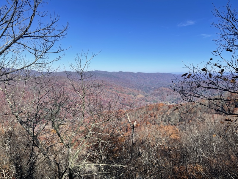
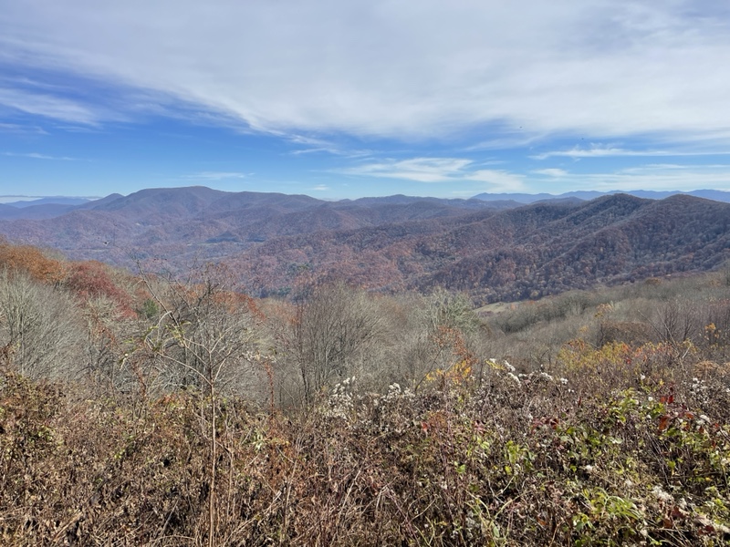
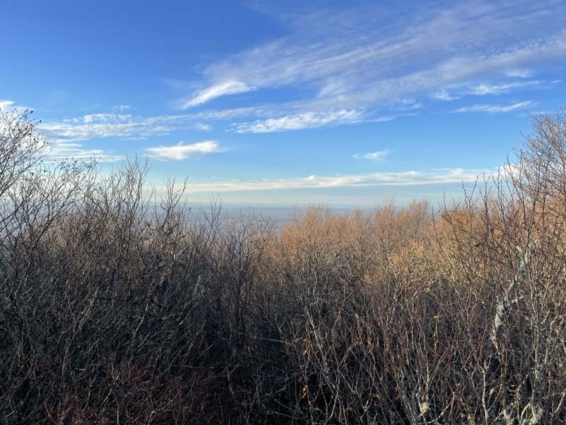
The climb went by nicely, and I was greeted near the top with an exquisite view looking back across the way at Big Bald, Sam’s Gap, and over to the Smokies, which had beautiful, thick cloud cover sitting among the peaks.
It was absolutely stunning, and I stopped to admire the view and eat a protein bar at the same time. Soon I was caught in the moment, having a dance party of one to Rihanna’s Disturbia, my full pack no longer feeling like too much of a burden as I swayed to the music, in love with the moment.
Immediately after the uphill, the trail dropped me 1,600 feet over the next 2.7 miles. I switched to an audiobook as I followed the trail as it curved around the mountain, trying to lean back as I descended, lengthening my trekking poles to support my knees, making a mental note to massage them at camp later.
I passed a small view and a couple with their two dogs, and began seeing water sources coming from Sugarloaf Branch. I stopped at one of them, needing water and to eat lunch. It was 2:20 and I was now 7.56 miles into my day, pacing me just under 2.5mph.
I ate a couple pieces of pepperoni pizza I’d packed out, mixed up propel and caffeine but only a drank a couple sips, saving the rest for later. I downed almost a liter of water before continuing on, stopping for a minute when I ran into Steve, a local shuttle driver I’d met a couple days back at a road.
Steve told me he’d left a cooler with fruit in it by Devil’s Fork Gap, and reported a couple bear cubs had been seen nearby today. A section of northern Tennessee had just been closed the other day due to bear activity, though I was well past that stretch of trail.
I thanked Steve for the fruit, and kept descending toward Rector Laurel Road. On the way, I crossed a fence, and looked to my left to see a group of three men with farming equipment in the middle of the woods. They stared at me, till I raised a hand in greeting and my wave was returned.
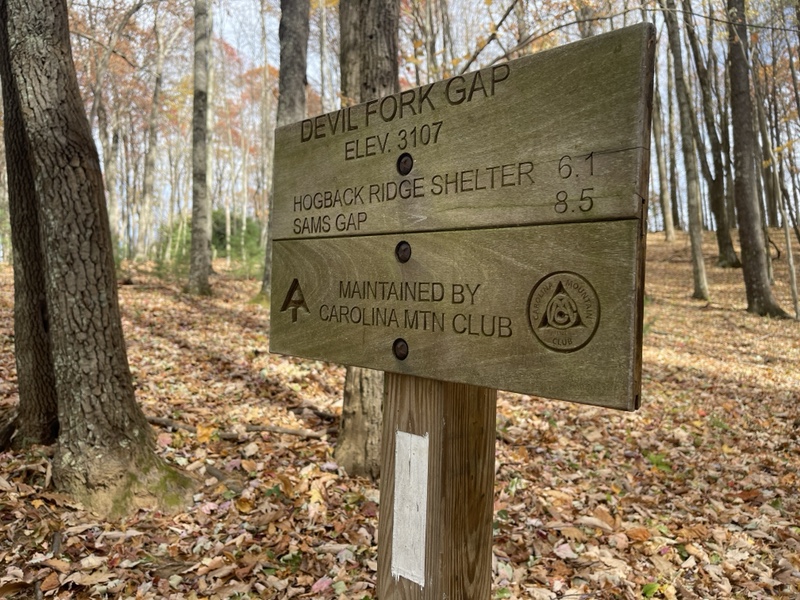
I crossed the road, then climbed one more hill, Devil’s Fork Gap on the other side. I helped myself to a banana, then started up an easy 2.5 mile ascent of only 600 feet to Flint Mountain Shelter, my possible bail out point if I needed.
I was rather creeped out when I was walking along and saw a palm sized spider swinging from a web down to the ground directly in front of me. I hadn’t seen any spiders that big in weeks, and shuddered to imagine it landing on my head from above if I’d been there just a little sooner.
There was a variety of bugs, bees, and butterflies that had been making appearances again now that things had started warming back up. I didn’t mind, as long as I didn’t see any mosquitoes or ticks; I’d stopped carrying bug spray back at Woods Hole Hostel.
I arrived at the shelter a little after 4PM, feeling rather tired when I got there. I made use of the privy (amazing how much I missed those), and downed the remainder of my propel and caffeine. I wanted to hike the remaining 5.9 miles, and had been committed in my mind since the start of the day.
I ate more candy, thinking how I was seriously going to have to reinstate my healthy eating lifestyle after the trail, signed the logbook, and scurried off up the trail again around 4:30. The first mile dropped me into a little gap, where I began the climb up to Big Butt, a 4 mile ascent of 1,500 feet.
My workout mix playing in my ears, I started up the incline, knowing only the first mile or so was the steepest. The climb mellowed after that into an extremely pleasant grade, which had been my favorite type of hiking for the day, easy on my knees and allowed me to balance my pack directly on my back, making it feel much lighter.
I was pleased upon checking the clock at 5:28, seeing I’d managed to cover 3.12 miles on the uphill in only an hour. The caffeine had hit the spot, and I was glad I’d saved it till the final push. I ate cherry pop tarts as I kept going, knowing the sugar would keep me fueled.
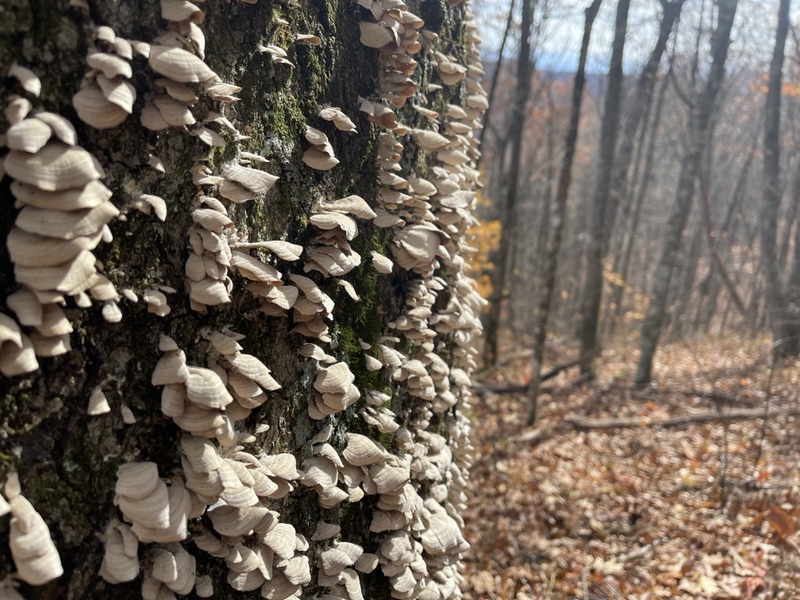
The sun was sinking low in the sky, and sometimes I was on the opposite ridge, making the trail much darker around me, then I’d rise up again into sunlight, feeling like I’d just time traveled to earlier in the day. Greenery surrounded me as I got closer to the top, emerald hues of ferns, mosses, and rhododendrons on either side of me.
Bumping to music and feeling great, I arrived at the top and took a short side trail to Big Butt, site of many joking comments in the Far Out guide. I was rather underwhelmed with the almost nonexistent views up top, expecting another bald but ending up surrounded by trees.
Glad the ascent was completed, I hiked the AT around the peak to the other side, 1.9 miles downhill to the shelter. The grading was rather gentle, fortunately, after I’d clambered down the rocky section up top.
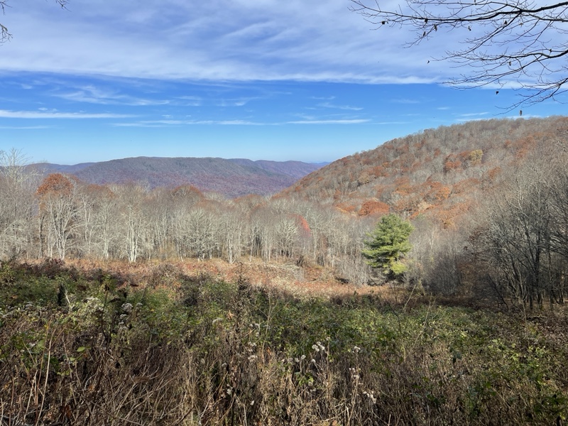
A mile into the drop, I hiked through a lovely field, belting out All I Want by A Day to Remember, feeling fantastic. I stopped at another gorgeous view, sunset only minutes away. I watched the sun sink over the ridge, unable to tear my eyes away until clouds obstructed my view.
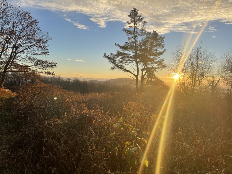
As I reentered the woods, I took my sunglasses off, perching them on top of my hat. Like magic, the remaining daylight kicked up a few notches, and I switchbacked down the ridge, watching the conclusion of sunset behind the clouds and through the trees.
I got to camp at 6:45PM, almost exactly as planned. I found the shelter deserted, and I dropped my things before taking a quick walk to the water source to collect a couple liters.
I set up camp in the shelter, changed into warm clothes, and sat eating my remaining pizza, oatmeal cookies, and chips while watching Atlanta out loud because I was the only one there. I wanted to use human sounds to keep the bears away, as I saw there was a comment that cubs had been seen there earlier today, and it was already full dark just after 7PM.
It was rather windy on the ridge, but the shelter was set up perfectly to block the wind. I stood in the clearing for several minutes, staring up at the stars, astounded to see two faint shooting stars in a row above. I made my two wishes, then crawled back into my quilt.
The evening was mild, a low of 46 degrees, and when I heard a scratching sound on the roof I turned my headlamp on to see if it was mice running around. I realized it was actually rain pattering down. It hadn’t been forecasted, but I was glad I was staying in the shelter and wouldn’t have to pack up a wet tent.
Iroh had been hoping to make it to the shelter around 10PM, but without service I could only assume he’d stopped at Flint Mountain Shelter. I couldn’t blame him for that, as I certainly was no fan of night hiking. It was my third or fourth time camping totally alone, and I did my best to keep my imagination under control, watching The Queen’s Gambit and reading the shelter logbook until I drifted off.
The logbook was very entertaining to me, as I’d been thinking about how green the NOBOs must have been at 300 miles in. I assumed it had taken most of them about a month, which was confirmed when I saw multiple comments about hikers hitting their 300 miles at 30 days.
I also saw that this was around the time many of them were pulling their first 20 mile days. The comments indicated their exhaustion, and I remembered how I could barely walk after my first couple 20s, even this time around. It was a fun read, and made me grateful for how far I’d come, and what I still had left to go.