
Nauman Tentsite 1855.3 to Edmands Col Cutoff 1863.7 (8.4 miles, 838.3 total miles)
Last night on the tent platform I left my rain fly off, and Sunshine cowboy camped next to me. We watched the stars come out and chatted for a bit before bed. I saw a shooting star right over my tent before falling asleep.
I woke up at 1:30, cold and sore, and couldn’t fall back asleep until more than two hours later. When my alarm went off at 4:44, I couldn’t hit snooze fast enough.
It was a rough morning, and I could feel my lack of sleep immediately. Sunshine was not feeling great either, and she left before me to make her way to Mount Washington, where her dad would be meeting her.
Coasty, Snoopy, Halfway, Long Story, Clean Machine, Trash, and Yogi all left before me as well. Everyone had the same plan to hit Lakes of the Clouds Hut in 5 miles to buy some leftover breakfast if we could.
There was no sign of Catchup when I left at 6:45, but that is why he is named Catchup. He will leave last, catch up, and still get to camp first.
There was a short, steep uphill to start the day, and I flew by a few hikers as I went along. I was tired, but had drank a lot of caffeine to rev me up.
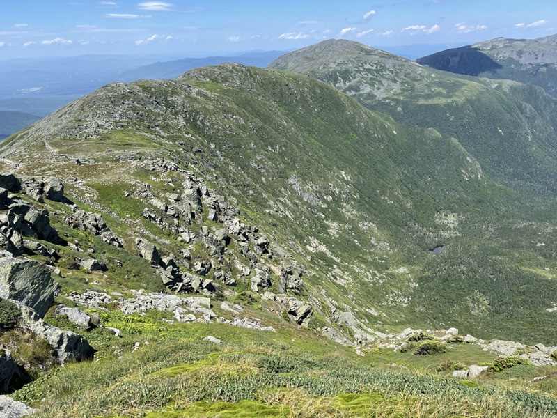
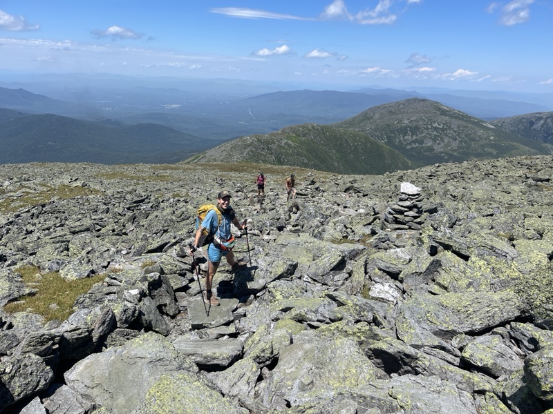
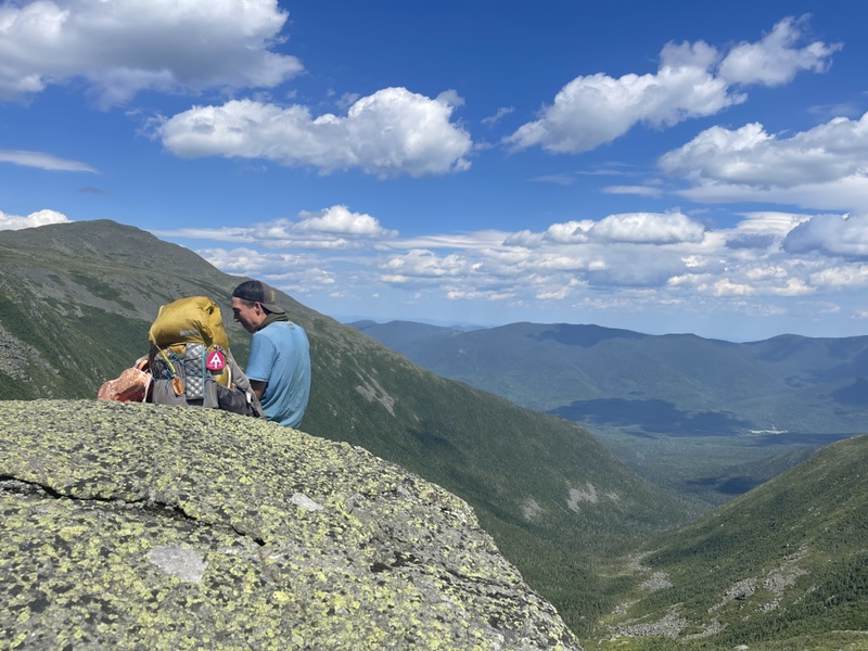
Quite soon the trail started flirting with the treeline. Eventually, I was hiking on completely exposed terrain above the trees. There were several ascents and then flat sections, and I admired the ridges behind and in front of me as I hiked along.
The day was sunny but cloudy, and I was hoping against hope for amazing weather at the summit for Sunshine because this mountain was so important to her. I’d already experienced a beautiful day on Washington, and I wanted her to have that as well.
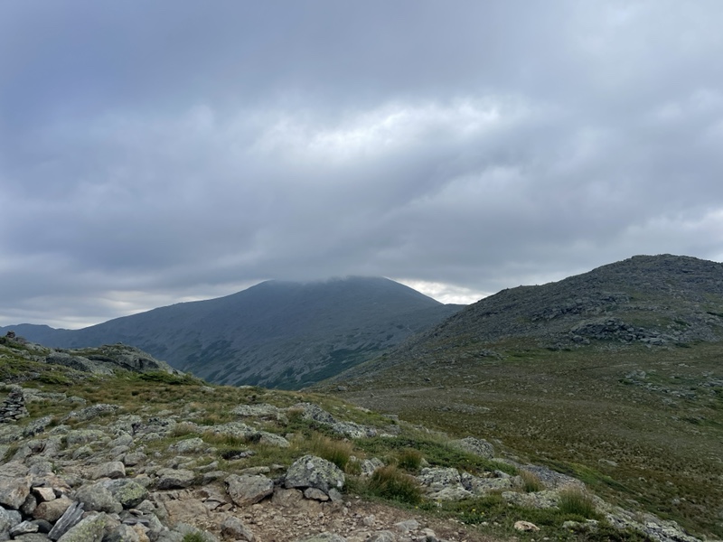
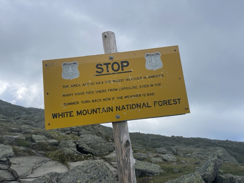
Unfortunately, when I was a couple miles away from the mountain, I saw clouds descend upon the peak of Washington. I watched them, but they stayed perched there, obscuring the summit.
I was feeling tired by then, and hadn’t eaten enough. So I drank more coffee and ate trail mix, but my stomach wasn’t loving all the caffeine. Slightly nauseous, I pressed on.
I realized on top of Mount Monroe that I had accidentally taken a blue blaze and peak bagged another New Hampshire 4K. It was a gorgeous view, and followed parallel to the AT.
Lake of the Clouds was at the bottom of the mountain, nestled in a valley. Everyone else had already arrived and was sitting at a table eating baked goods.
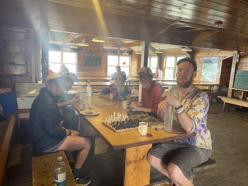
Leftover breakfast hadn’t come out yet, so I cashed in on one of my free baked goods that came with my AMC thru hiker pass for a piece of carrot cake with cream cheese icing. I really wanted something savory at that point, but there wasn’t anything that fit the bill.
Everyone headed out around the same time, and since the trail was still over tree line I followed the cairns. I saw Trash and Yogi ahead, but soon I ascended into the clouds, and couldn’t see much around me.
I reached a trail junction, and realized I wasn’t on the Appalachian Trail for the second time that morning. There were many criss crossing trails covering the White Mountains. There were signs, but in my tired state I had missed something.
I was on a trail that wasn’t even marked in Far Out as a blue blaze side trail. I saw the AT didn’t seem to be too far away, so I hiked through the alpine zone, doing my best to only step on the rocks and not the fragile moss and vegetation around.
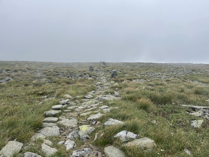
I walked for several minutes, and saw my arrow wasn’t moving any closer to the trail. I was surrounded by clouds blowing in the wind, and could see very little of what was around me.
I realized I was potentially getting myself into a dangerous situation, especially because I had no cell service. I turned around back to the other trail, where I saw the sign for a Tuckerman trail, which is what I’d been following accidentally.
The sign said it was 1 mile to the Washington summit, so I continued to follow it. Sunshine was leaving soon, and I didn’t want to miss her, so I figured it would be less time consuming than retracing my steps.
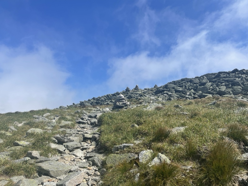
Fortunately, after not too long I reconnected with the AT at another trail junction. The summit was .6 ahead. The sun came out, and I saw the much more direct AT route from the hut below me that I had taken the last time I’d climbed Washington.
I was alarmed to see Coastie running back down the trail without his pack, and a hiker sitting to the side of the trail. I was worried someone was hurt and Coastie was going to get help.
I had enough service by then to call Sunshine, because she was my immediate thought in that moment. We talked for a few seconds before the call dropped, and she said she was almost at the top.
The other hiker got up and started moving, and Sunshine texted me that Coastie had forgotten his wallet at the hut and was going to get it.
Back on the Appalachian Trail, there were weekend hikers all over the place. I said hi to those I passed, and as I got closer to the top, the clouds began to blow away completely off the summit.
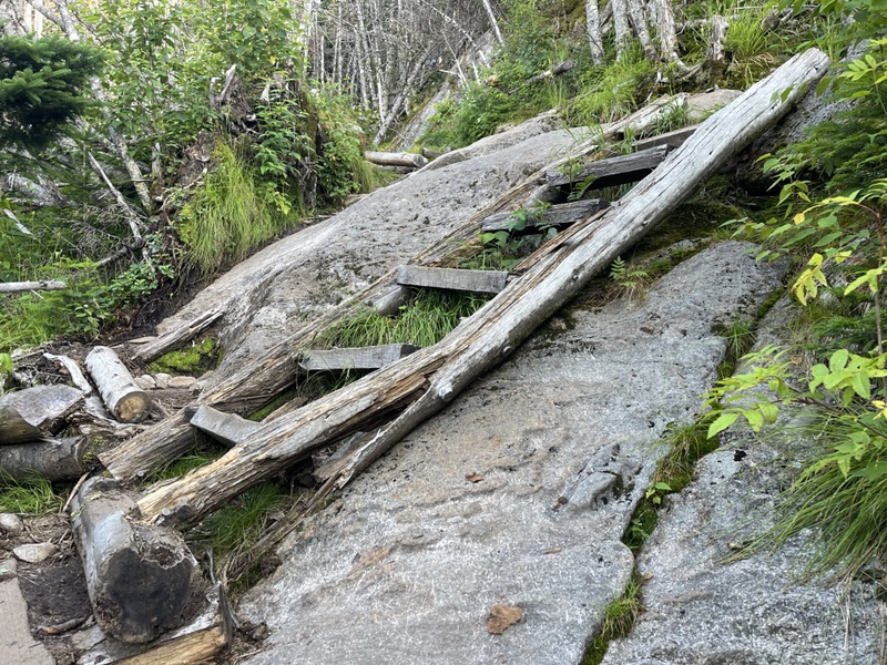
I was very relieved at that, but tired as I dragged myself up the last bit. The trail had been extremely rocky and steep the last few miles.
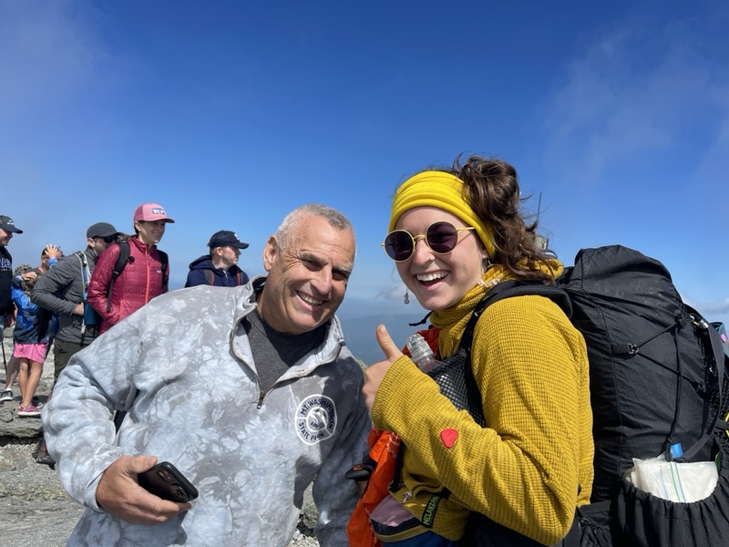
At the top, I found Sunshine and met her dad, who we called Papa Sunshine. He was a very lively and friendly man, and he treated Sunshine and I to lunch in the lodge. First we grabbed summit pictures together, since the line to the sign wasn’t too long.
We checked out the gift shop, where I bought a couple stickers for my trekking poles and a hiking necklace. We went to the little cafe, and Halfway came and ate with us as well.
I had Italian wedding soup, a hot dog, some fruit, and a couple snacks for the road. I was feeling extremely lethargic from lack of sleep by then, and was glad to see Catchup when he arrived.
He took Halfway’s seat, who was hiking out, and we filled each other in on our mornings. Sunshine said she would need one more day before getting back on trail.
Catchup and I told her we were fine waiting in Gorham a little longer, and I made her promise she’d come back to the trail. We all wanted to summit Katahdin together, and I was feeling much more relaxed about the timeline, anxious to spend more time with my friends before going back down south.
I also told Catchup that I had found a stealth spot to camp a couple miles before Madison Spring Hut. I was just so tired, and we weren’t sure we could get work for stay at the hut with so many other hikers around.
He was happy with that plan, and we would end up with a 10 mile day to Gorham tomorrow. Since we had two zero days now, it wasn’t a problem to do a longer day tomorrow off the range.
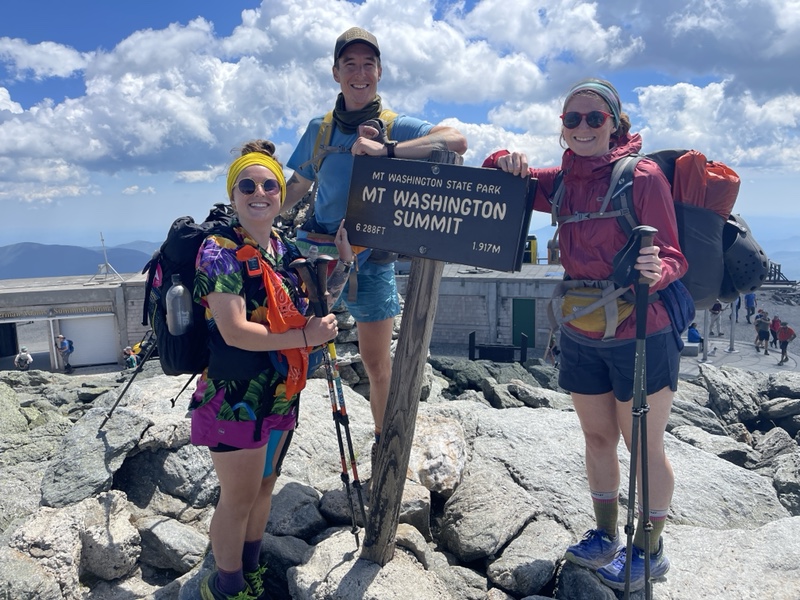
We all went back outside to get summit pictures of the three of us. The line was much longer now, as the summit and lodge was crawling with people who’d hiked, driven, or taken the cog railway up to the top.
After pictures, we were all ready to get away from the plethora of people around. We said our goodbyes to Sunshine and Papa Sunshine, and I was sad to see her go, and very sad she was losing her beloved dog.
Catchup and I collected some water and hurried off the mountain, where the trail was still going to be exposed for the next several miles.
Catchup wanted to do a little more peak bagging, and I was on board since we were hiking a shorter day. I seemed to get some of my energy back as we started moving, or maybe it was the Powerade I’d downed before we left.
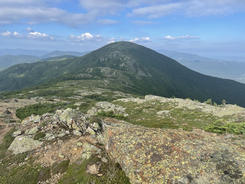
We took the blue blaze trail over Mount Clay, and then another one to go over Mount Jefferson. Same as Monroe, they were both parallel to the AT, but included elevation that the AT did not.
We hiked through strong winds for the rest of the afternoon, which tired both of us out. The trail was rocky and rugged again, as we hiked up and down each peak. They were the type of rocks that looked like they might move underfoot anytime.
The trails were still covered with day and weekend hikers, many of them doing the Presidential Traverse or the hut traverse.
We chatted with several of them, and said hi to many, but by the end of the day we were both feeling burnt out from exchanging pleasantries with so many people.
At the base of Jefferson, we turned onto Edmands Col Cutoff to find the stealth spot I’d read about in the Far Out comments.
It turned out to be an amazing location, with an unmarked water source and a fantastic view of the mountains ahead, with a large valley in between. It couldn’t have been a more picturesque place to camp.
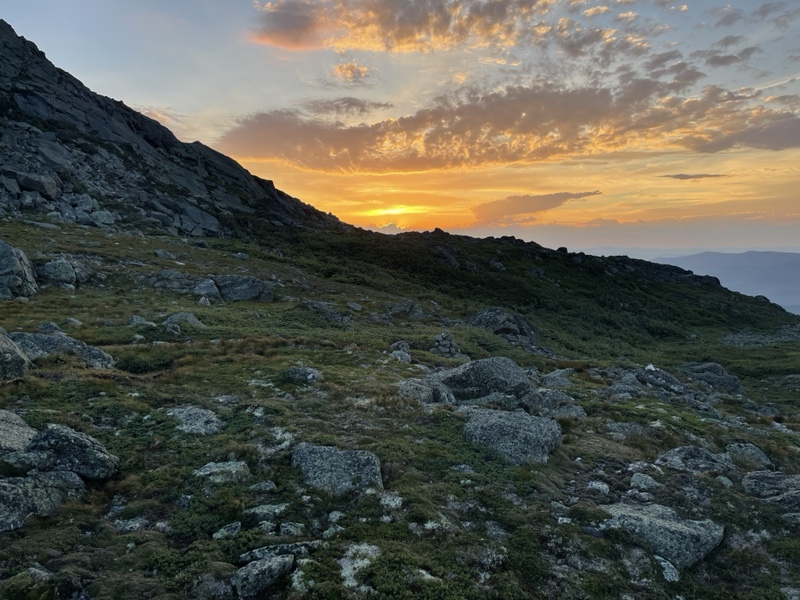
We had dinner and went back up to the ridge to watch the sunset. It was incredibly windy there, but our site had three enclosed walls to block out the wind.
There were clouds covering the setting sun, but it was still stunning, with fluffy cumulus clouds painted pink and orange in the distance, and rays from the sun shooting up from behind them.
As we walked back to camp, I said an out loud thank you to the White Mountains for the amazing, magical times we’d had. I thanked them for hosting us and granting us safe travels throughout.
Watching the clouds roll off Franconia, seeing the rainbow at Zealand Falls, and so many other amazing memories with the people I now considered another trail family to me, Sunshine and Catchup.
The Whites have a mystical, ancestral energy to them, and were truly healing to me to traverse a second time.
Almost in answer to my prayer of thanks, we saw a little bird that hopped along the tree branches next to us as we walked back to camp. It had food in its beak, which Catchup said seemed like a good omen to him.
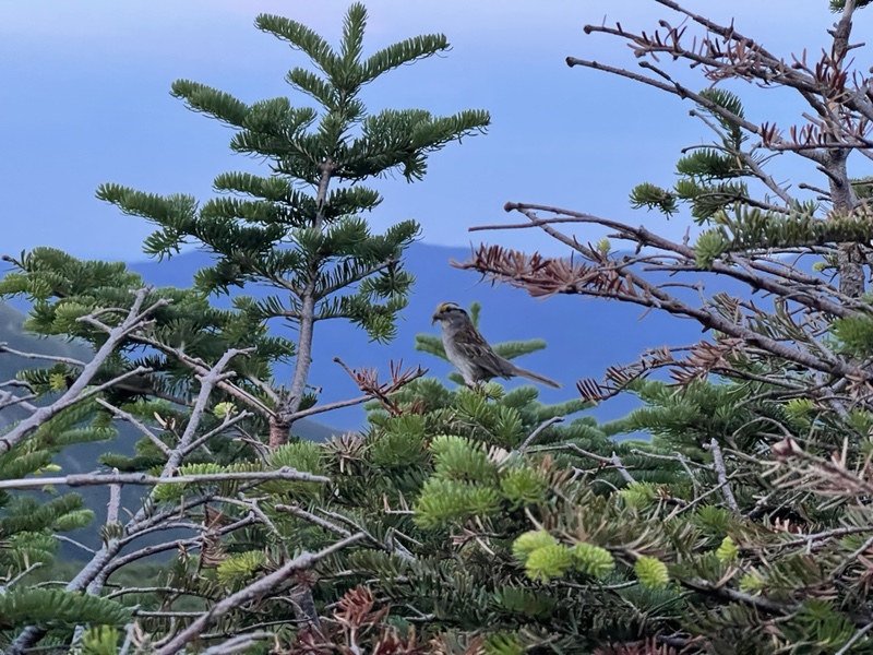
I always think it’s Frankie saying hi when moments like that happen, but it also felt like the mountains were saying “you’re welcome”. I know it sounds far fetched, but life is short, so why not believe what makes me happy?